Every year, wildfires destroy millions of acres of land, costing billions in damages and threatening countless lives. The scary part? Many fires could be detected earlier—but current systems aren’t fast or efficient enough. This issue is what inspired my project.
–
Overview
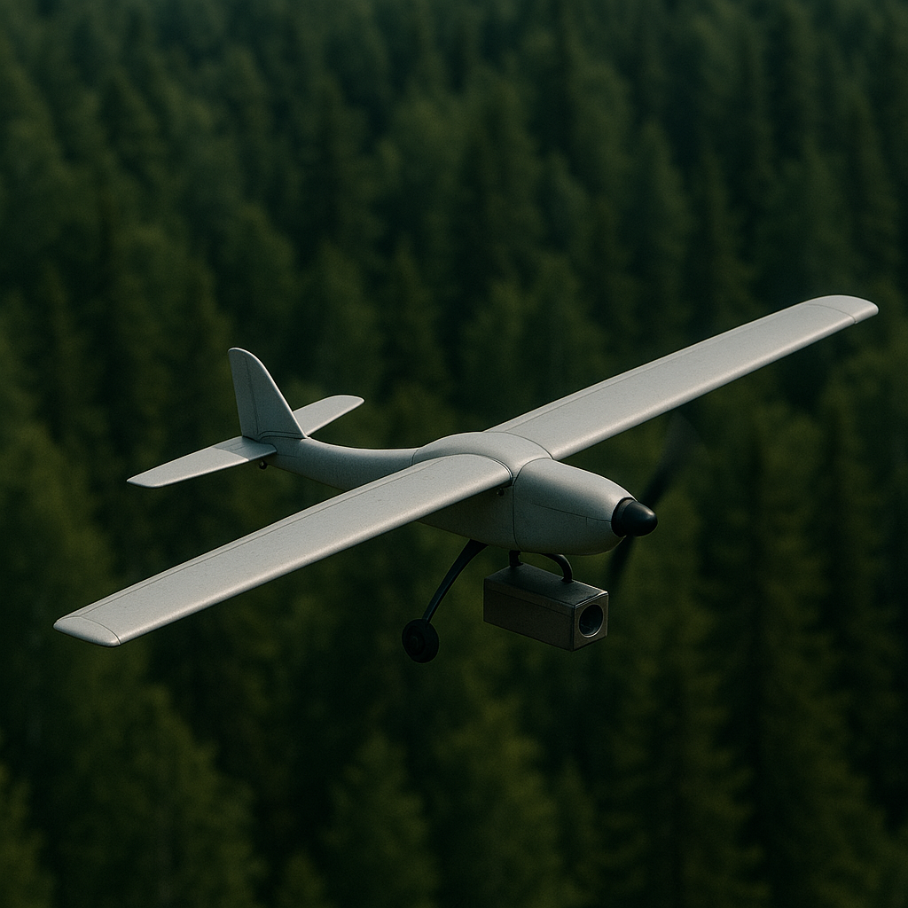
My project is, in simple words, a wildfire detection system. The final product will use a drone with an infrared camera, along with other sensors, that is capable of detecting small fires in the wilderness and reporting the GPS coordinates to humans. The aim of this project is to decrease the amount of time it takes for fires to be detected in the wild. If response time is significantly cut for these fires, they will be much more manageable and could be easily extinguished.
–
Existing Solutions

Quite a few methods for detecting wildfires currently exist and are currently being used. However, they each come with disadvantages…
Fire towers:
Fire towers have been used for more than a century now, and are a simple, straightforward, and widely used way to spot fires in the wild. Unfortunately, because of their primitive design, it comes with many inconveniences. A human has to be in it and alert on the lookout for fires at all times. If the tower needs to be built deep in the wilderness, it’s also very difficult to transport building materials to that location and send people over there to assemble it. Plus, the limited range of human vision means that there needs to be many built throughout an area for it to be an effective solution.
MODIS:
MODIS is one of NASA’s satellite systems. It stands for Moderate Resolution Imaging Spectroradiometer. These satellites are used to observe the surface of Earth, and importantly to spot wildfires from space. Nonetheless, it comes with many disadvantages. It is very expensive to maintain this system, as new satellites have to replace old ones and rocket launches are so expensive and bad for the environment. The satellites also cannot cover every single part of Earth at all times. It passes over a part of Earth only a few times per day, leading to delays in detecting premature fires. Lastly, the system becomes essentially redundant if there is thick cloud coverage, since the satellites completely rely on a visual detection system, so low visibility would mean it won’t be able to detect fires.
Drones:
Similar to my objective, drones have already been implemented in some regions to be used to look for wildfires. However, these drones are fundamentally different from my idea. All of them require a human pilot, which requires alternates to actually spot fires. Most of these drones are also converted military drones, which are extremely expensive to build and maintain. Also, these drones are designed to fly at high altitudes. This makes the drones less effective at detecting fires if there is low visibility, and it may cause regulatory issues with airspace it uses, since it flies so high.
–
My Solution
My project solves the issues that come with all of these traditional wildfire detection methods. It does not require any continuous human monitoring, it is cheap to produce and maintain, and it is much more flexible than other methods.
The drone will be made from cheap and accessible parts. These parts can even be used with Arduinos, which I will be using to create a demo of the final detection system. This low cost allows many drones to be built for the price it takes to produce modern wildfire monitoring drones.
The drone will fly along a preprogrammed flight path. It will loop in a small specific area, looking for fires, until its battery runs low. It will then return to a charging base, and by that time, a new one will have been deployed and it will have taken over the original drone’s assigned area.
Because of the low cost to produce one drone, we can make many. This allows the drone to be much more flexible than a single drone. If one specific area needs extra monitoring, more drones can be sent, each covering a small area to catch even the smallest fire. If an area is low-risk for wildfires, fewer drones can be deployed. Each one can fly higher and in a larger area, lowering any unnecessary maintenance costs.
–
Potential Challenges and My Solutions
Along the way of planning out my project, I identified some potential issues that the system may face. Here are some of the biggest ones, and how I plan to address them.
- There are no cell towers in the wild. How will your device report any fires detected?
It will report by either returning directly to the launch station if they’re close by, or by relaying the information to nearby drones so that the info can be passed on to responders without the drone needing to fly all the way back. This method reduces components used, reduces weight, and reduces cost. - The drone has limited range right?
The cheap cost to produce these drones means we can have many deployed at once, each covering a smaller area, so no one single drone has to travel far. The many drones also means they can be in rotation, so one can take the place of another when that one runs out of charge. - Since the drone is flying, how will it detect fires if they’re small and underneath the canopy?
The final product will have more than just a infrared sensor. It will have sensors that can identify smoke through things like carbon monoxide. The drone isn’t designed to be able to detect the tiniest spark. It is just to significantly reduce the detection time of a already burning fire, so the fire would most likely have to big enough to surpass the canopy.
–
Leave a Reply to mcrompton Cancel reply